FINAL REPORT (October 2023):
The Quest for Ancient Inscriptions: The results of a challenging exploration of the
Turkish-Iranian border in search of ancient inscriptions possibly related to Noah’s ark
Conducting an Exploration Along the Turkish-Iranian Border: The Search for Ancient Inscriptions Commemorating the Landfall of Noah's Ark

Written by Andrew Jones, July 31, 2021
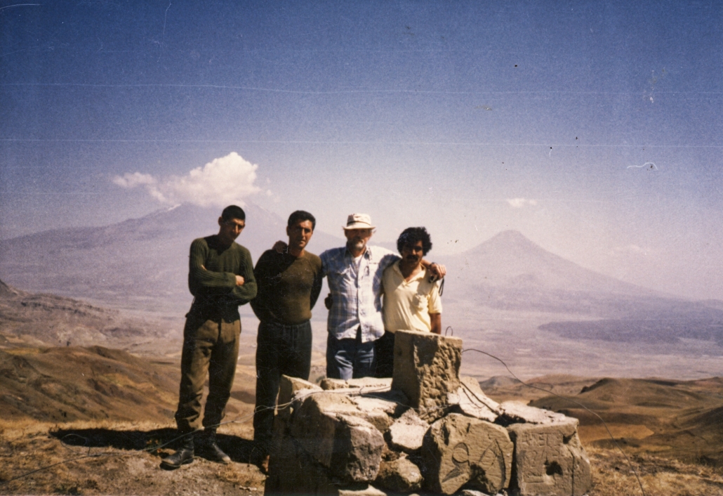
Earlier last week I did something very rare. I flew a drone from the Turkish border over into Iran to document the Iranian sides of these stone border markers. The question naturally arises, why the need for deploying a drone along this militarized zone? The answer can be traced back to the mid-1980s when Ron Wyatt that he had saw inscriptions and carvings on the stones that made up these border markers. Our current endeavor is to more thoroughly document these fascinating possible historical inscriptions.
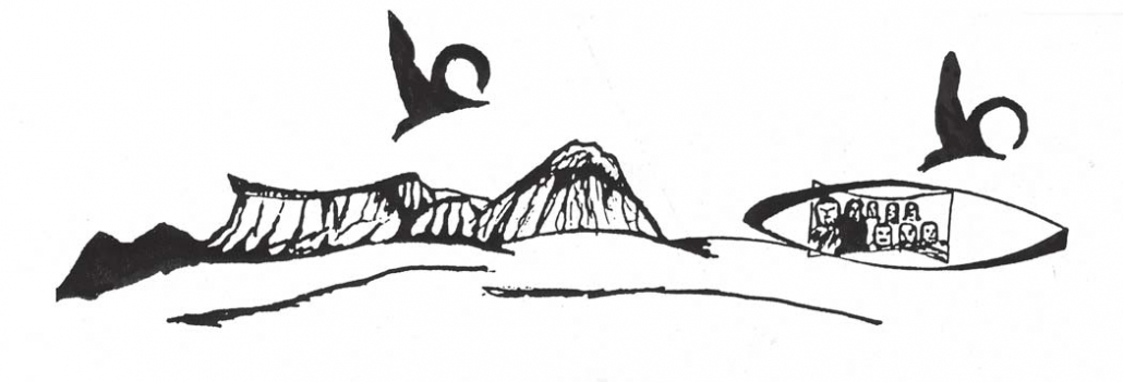
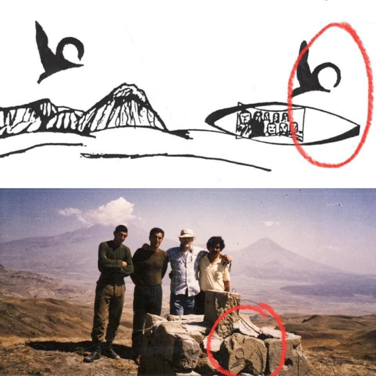
In 1984, “As Ron and Mr. Baser proceeded up the mountainside to the top of the ridge near the Iranian border, they encountered another amazing discovery. Near the top of the ridge, Ron found broken pieces of stone which contained an inscription. The pieces were being used in a more recent structure which looked to be a boundary marker. The broken pieces were quite large and most had the side with the inscription exposed which allowed him to see them so he could try to draw a reconstruction. These blocks contained numerous inscriptions in what looked like three different forms of writing, but he didn’t recognize any of them except the cuneiform… He believed there was only one explanation- that it was erected in historical times to mark the location of the original landfall of the ark.” (Wyatt 69-73)
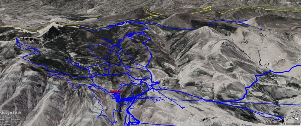
Over the last 8 years, we have been exploring much of the area around and above the Durupinar Noah’s ark site. We made our first visit to the Turkish-Iranian border on April 30, 2014 but the Turkish military base commander at that time wouldn’t allow us to go out to the border from the base. He was happy to take a photo with us and even said we could explore the ark’s original landing site valley below his base but to beware of the Turkish sheepdogs. We decided it was best to try to explore the landing site another time.
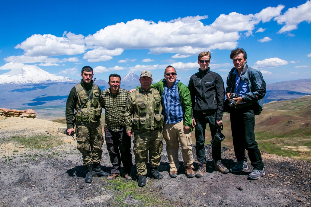
October 10, 2019 First official visit to the border
On October 10, 2019, we finally received official permission to visit the border. Our team included a Turkish archaeologist and an official from the Ministry of Culture and Tourism. We saw that there were a number of border markers all along the border spaced approximately every 500 meters and that was when we found that the border markers were behind barbed wire yet still standing and protected from tourists and locals. We were told though that the ground on the other side of the barbed wire was mined so we couldn’t yet get to all the sides of the stones in the markers to photograph them.
July 15, 2021 Second official visit to the border
Finally, God opened the doors to fly a drone multiple times from the Turkish military zone across the border into Iran with permission from Ankara, the Turkish military and the Governor of Ağrı province! Amazing!
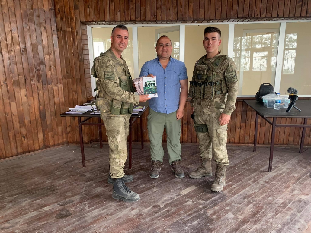
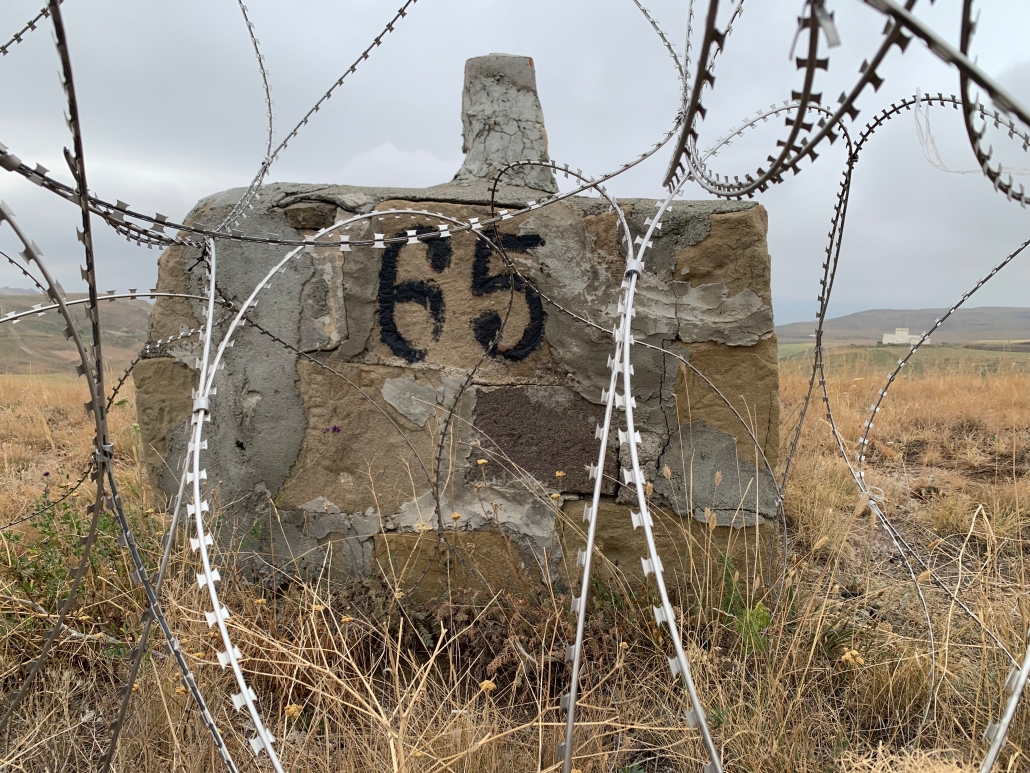
First, on July 15th we visited the border with a Turkish archaeologist and an official again from the Ministry of Culture and Tourism to document the stone structures with a DSLR camera. The military border base commander was the same one I had met a month early at Noah’s ark. He had come down to the visitor center to set up a photographic display board about Noah’s ark for a high-ranking military officer visiting from Ankara (see photograph below). He talked with me about the research and I gave him a quick presentation about the evidence and gave him two free books about Noah’s ark. He tried to drive us out to the markers along the border in his military halfback truck but a rare cold front had moved in and we were not dressed for the cold windy weather up there at 8,000 feet on the border. So we instead took our taxi out along the border wall road. We got as close as we could to border marker number 66 and went back to marker number 65 next to the military border tower.

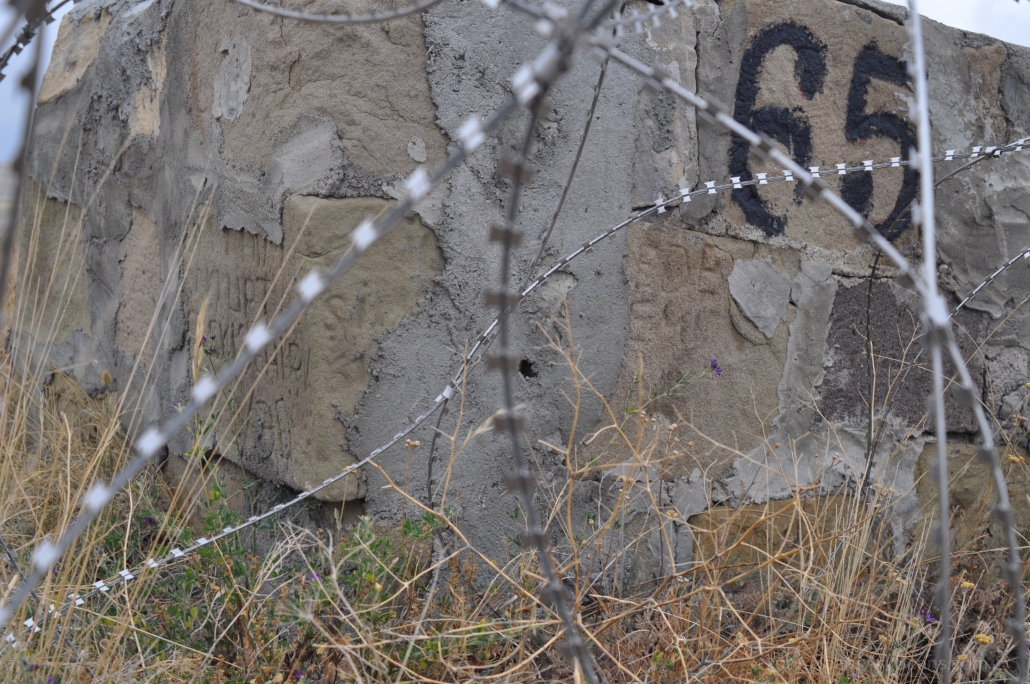
We noticed that border marker number 65 had new cement covering a lot of the top and sides. It looked like it was just recently repaired by the military. The commander and his soldiers tried their best to help us and even put a wooden ladder over the barbed wire fence to get to the other side so we could photograph the Iranian side of marker number 65. Just to be clear I did ask the commander if the markers were on Turkish soil or not. He said they marked the exact border with Iran and that the south-facing side of the stone markers was in Iran. We photographed markers 65 and 66 as best we could as they were next to the barbed wire but the other markers were farther away from the fence and impossible to photograph with the DSLR camera that we had with us. We knew that to better document all the sides of these markers that we needed a drone. We briefly discussed all this with the base commander and he was in agreement. We left to get the required permits to fly the drone if possible in this military zone.
July 27, 2021 Flying the drone on the border!
On July 26th we finally received word that we could fly the drone the next day!!! I was given specific instructions as to what to photograph (the stone border markers only) and what not to photograph (nothing in Iran and no Turkish military installations or personnel), how high I could fly (fly low haha!) and no video but only take photos. The first flight was a little stressful with the base commander and others looking over my shoulder and one of his soldiers standing near him at all times. The base commander even took out his phone and took a few photos of the drone flying. I changed memory cards after each flight to save as much data as possible in case the drone was shot down by the Iranians or crashed. I learned my lesson after we lost a $6,500 drone in Saudi Arabia in 2016. Also, I told them I wanted to document border marker #65 first as that is the one that had the “boat” and “bird” symbols carved on it that Ron discovered in the 1980s in case the drone had problems on the other flights for the other 3 markers. Thankfully we had no problems with the flights except for losing signal briefly around marker #64 which was out of site from the location I was standing controlling it on the border road so we didn’t capture one side of that marker. We also had no problems with the Iranians guarding the other side of the border. As we left the base commander came up to me and shook my hand and called me “patron” (Turkish for “boss”) hahaha. The Turkish archaeologist told me later that this was a very special request to fly a drone at the border and the permission came “from the very top” to allow me, an American (even though I’m a local resident now), to fly a drone there. No one has ever done this before not even Turks. God is good!!
What have we learned so far?
We first now know that the same border markers that Ron Wyatt discovered in the mid-1980s and later documented are still there protected behind barbed wire. We also found out that a lot of new cement repair work has been done to the markers covering up large portions of the rock. Our team only saw markings on the stones that look like Turkish or Farsi and nothing more ancient. One thing we noticed on our first trip was all the Turkish writing carved by the soldiers on the stones. Usually the writing consisted of their name and enlisted date per our local guide who has served in the military here. Read below the final report given at the 7th International Symposium on Mount Ararat and Noah’s Ark held at Agri University in October 2023.
The next steps in the research above Noah's ark along the Turkish-Iranian border
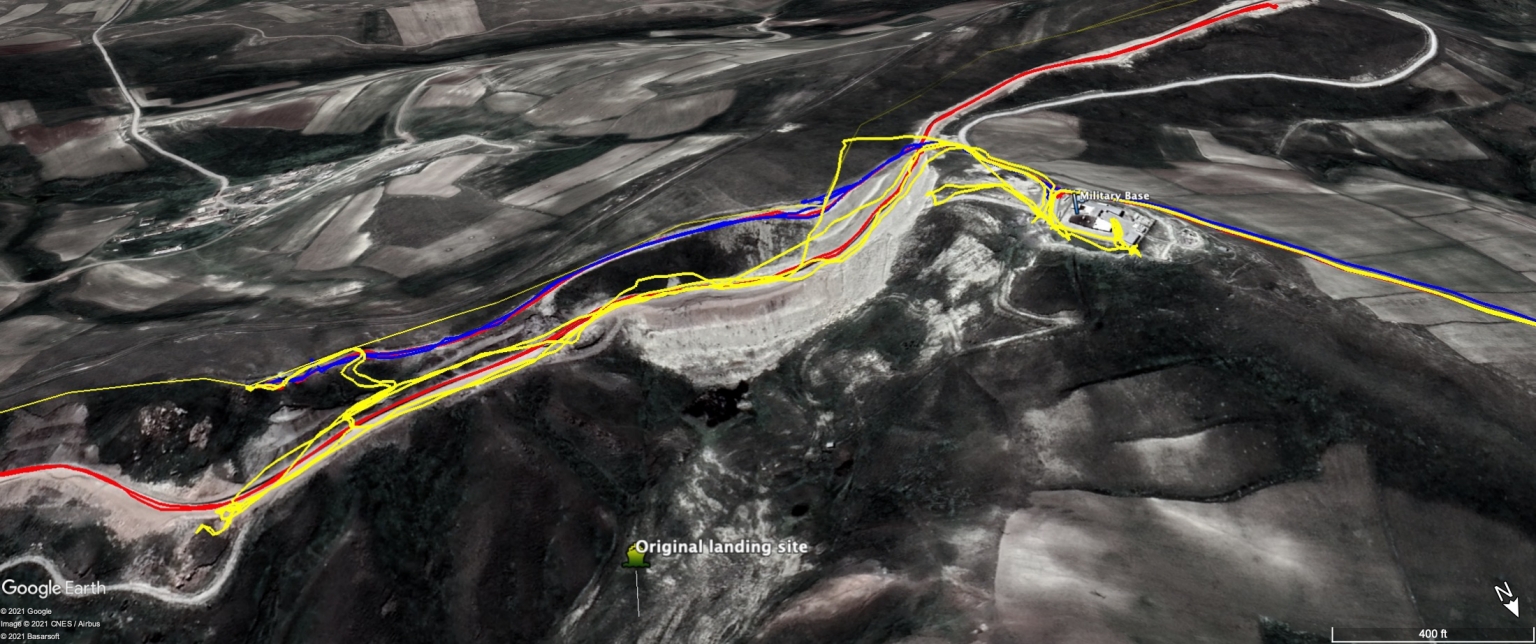
We’re not done yet too with the survey work there but have made two visits so far to the border. Due to the cement repair work seen covering a lot of the stones, we are applying for permission to take the stones down from the border to thoroughly investigate all sides after removing carefully the modern cement.
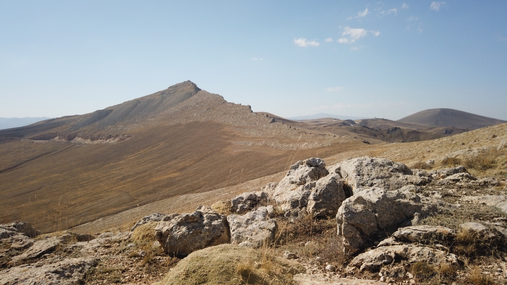
On top of all this effort along the Turkish-Iranian border, we also will be documenting the escarpment/ridge above Noah’s ark which is in the same military zone that no one is allowed to enter to try to locate the animal petroglyphs that Ron Wyatt saw there but couldn’t photograph.
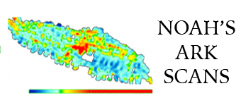
Finally, we will be doing on-the-ground survey work beside the border wall at the original landing site that Ron investigated to try to find the 120’x40′ section of the hull that he saw in 1984 there. All of this survey work is on top of the new GPR and ERT (aka resistivity) scans being done by our Turkish partners.

We need you!
For tax-deductible 501(c)(3) donations please visit:
Monthly donors exclusive video link below
See old video clips of Ron Wyatt and Dr. Bill Shea discussing the ancient petroglyphs on the border. Available exclusively only to our monthly donors.
Click here to become a monthly donor!
Support the research for a small $20/month donation to get access to our behind-the-scenes footage and exclusive content.
