Nestled within the borders of Turkey’s Ağrı province, an intriguing boat-shaped formation, known as the Durupinar Noah’s Ark site, has become a focal point of research for those speculating it might be the final resting place of Noah’s Ark. Located in the Gürbulak Valley near the Iranian border, sandwiched between the villages of Telçeker (Sürbehan) and Üzengili (Meşar), the formation captures the intrigue of all who visit it.
The formation, set against the backdrop of Akyayla Mountain and a mere 20 miles south of the summit of Mount Ararat (Ağrı Dağı), rests above the meso-tertiary rock units, a section believed to be free of tectonic deformations for an extended period. Given the urgency propelled by its potential as a significant tourist site for Turkey, immediate analysis and dating studies are required to dispel the cloud of uncertainty.
Despite its alleged historical significance, the Durupinar site has suffered from a lack of protective measures. The area is exposed to animal grazing, and unauthorized entrance by outside visitors and researchers. Preservation is crucial if it indeed houses the remains of Noah’s Ark; even the slightest disturbance could prove detrimental to accurate research. The risk is not only to the site, however. Deep crevices in the structure pose a considerable danger of accidents and severe injuries.
Field observations have revealed severe crevices on the structure’s edges, a result of natural erosion and repeated landslides that now threaten the formation’s integrity. Rainwater, draining down the surrounding slopes, furthers the erosion, indicating a need for the installation of effective water diversion systems. As part of the preservation plan, it’s imperative to create landslide susceptibility maps using geographical information systems, helping to minimize the risk.
Recognizing the importance of preserving this site, the Ministry of Culture and Tourism’s Immovable Cultural and Natural Assets High Council, with a decision dated 17.09.1989 and numbered 3657, designated the location a natural protected area.
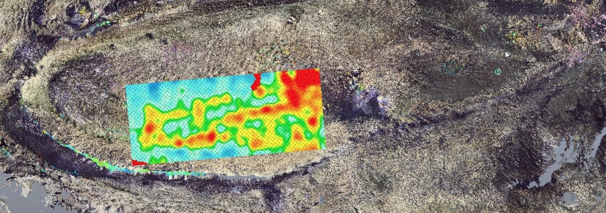
Observations and examinations have been conducted in the area where Noah’s Ark could potentially be located. As a result of these initial studies, a research plan was developed. In October-November 2021 a Turkish geophysical team performed an extensive Electrical Resistivity Tomography (ERT) survey, a geophysical technique for imaging subsurface structures based on electrical resistivity measurements made at the surface.
In a collaborative effort to unravel the mysteries of the Durupinar site, teams from Agri University and Istanbul Technical University came together in November 2022 to embark on a scientific exploration of this enigmatic geological formation. In their pursuit to delve deeper into the history and formation of the site, these scientists have collected various samples from the location, which are currently undergoing rigorous laboratory testing.
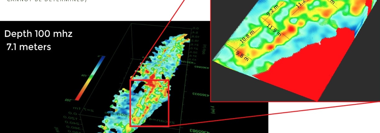
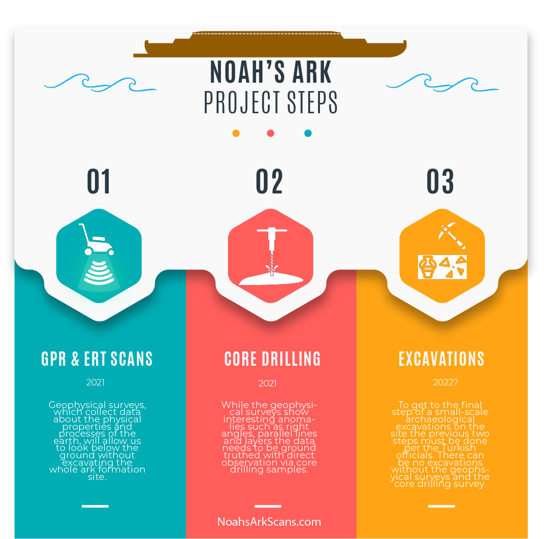
In addition to the lab testing, the upcoming summer will witness an expansion of the geophysical survey work on the Durupinar site. Armed with ground-penetrating radar (GPR) technology, the combined forces of the two university teams will continue to examine the site’s subsurface. The use of GPR scans will provide an in-depth and detailed understanding of the buried structures and features, further illuminating the hidden characteristics of this compelling formation. These concerted efforts underscore the scientific community’s commitment to unveiling the secrets that the Durupinar site may hold. The final stages might include core drilling and geological testing of the rocks at the site, and if warranted, potential excavations.
For more information on the topic of Noah’s ark please check out the Answers in Genesis resource page here.
Scientific Project Details
- Initiate orthophoto photography and LiDAR imaging via unmanned aerial vehicles (UAVs) for the delineation and mapping of the region identified as Noah’s Ark.
- Undertake a comprehensive geomorphological survey of the region and its peripheries to assess the implications of regional geology and inherent natural factors.
- Construct detailed geological maps of the immediate and extended periphery of the Noah’s Ark region, utilizing scales of 1/1000 and 1/5000. Integrate pertinent geomorphological, tectonic, hydrological, volcanic, and sedimentological data from the Noah’s Ark site into these maps.
- Incorporate the proposed location of Noah’s Ark into the aforementioned geomorphological and geological maps. Proceed with the creation of two-dimensional and three-dimensional spatial images of the region. Systematically map all accessible geographic, hydrogeological, geological, and geomorphological data employing Geographic Information Systems (GIS).
- Develop two-dimensional and three-dimensional subterranean models through a combination of aerial and terrestrial geophysical measurements (ERT, GPR, magnetometer, thermal) in the region speculated to be Noah’s Ark. Complement the geophysical data display in two and three dimensions with geological information. Apply ground-penetrating radar (GPR) and Electrical Resistivity Tomography (ERT) for subsurface imaging.
- Implement a core drilling survey and perform a subsequent analysis of geological samples extracted from the surface and core drilling. Conduct tests to ascertain the age of these samples.
- Acknowledge and address the severe erosion observed in the vicinity of the Noah’s Ark site. Employ geotechnical methods for prevention and restoration of the damaged area. Recognize the potential loss of the site’s cultural value and the consequent negative impact on regional tourism if immediate remedial measures aren’t implemented. Base necessary improvement studies on the aforementioned research findings.
As more data becomes available, validating the hypothesis that the boat-shaped formation in the Telçeker region, within the borders of Ağrı province, could indeed be a ship, the scientific, academic and touristic interest in this region is expected to intensify. We encourage and appreciate your support for the ongoing scientific study of the Durupinar Noah’s Ark site through your generous donations.
*It’s important to note that the direction and details of this project are under the stewardship of Turkish scientists, who reserve the right to modify project specifics as they deem necessary based on the evolving nature of the research.


